Projects webmaps, tools and mobile applications
🇨🇭SwissTrains for iOS
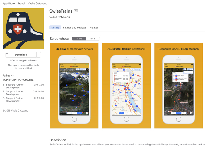
Time to animate the Swiss Railways on iOS devices! Besides displaying all available trains swiss stations you can also follow them in Apple's Flyover(3D) map mode.
Zürich Offline Map
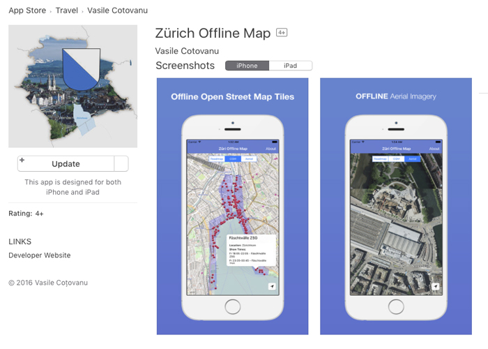
This iOS app stores the OpenStreetMap tiles and Zürich Canton's newest orthophots so you can use them offline, no data connection is needed.
San Francisco Transit iOS App
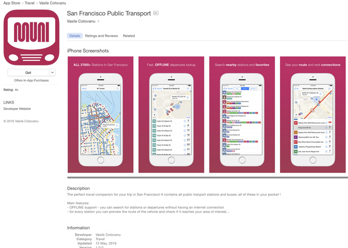
Departures iOS app for the city of San Francisco. Functionalities: offline support for departures, vehicle routes, nearby stations and favorites.
Romanian Railways iOS App
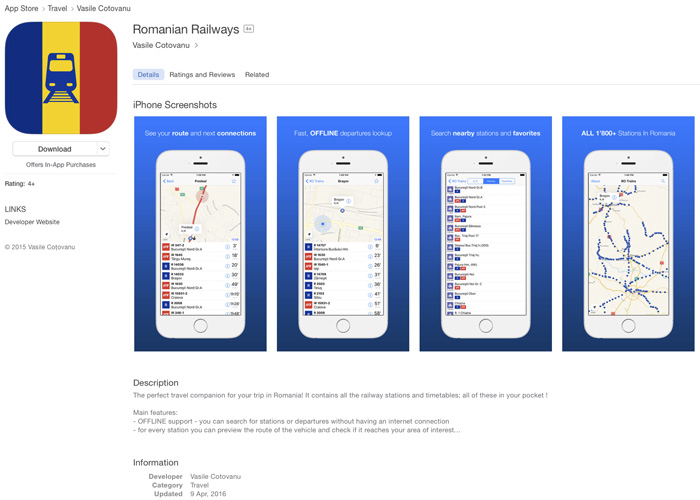
Departures iOS app for the romanian railways network. Functionalities: offline support for departures, vehicle routes, nearby stations and favorites.
GTFS for Romanian Railways
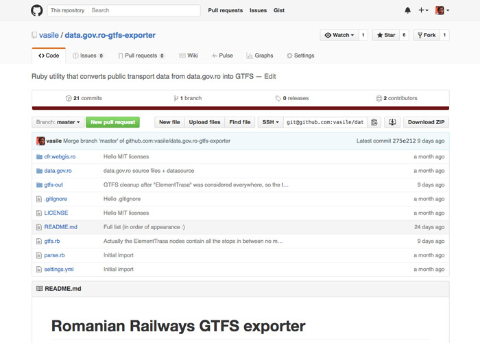
This tool converts raw timetables data from data.gov.ro in GTFS format. The output it's used in the romanian railways iOS and web apps.
Swiss Transit Colors
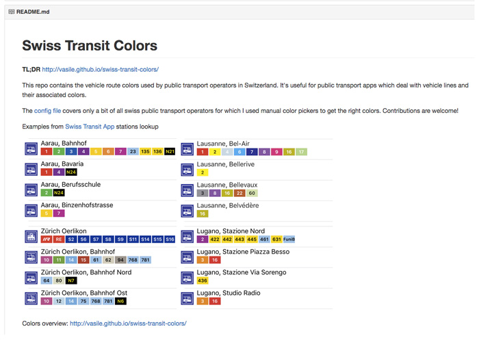
This tool generates the vehicle route colors used by public transport operators in Switzerland.
Tenerife Transport iOS App
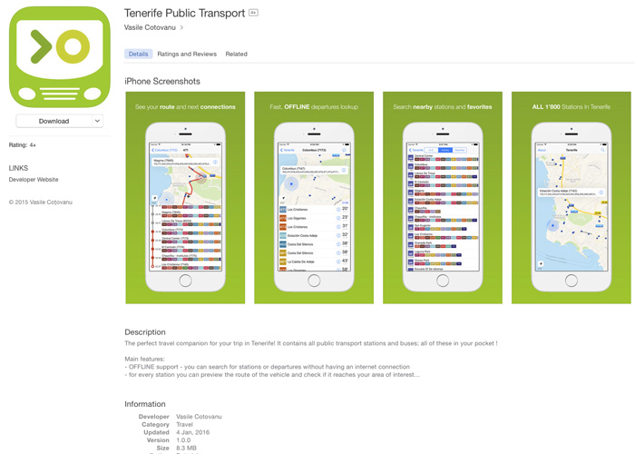
Departures iOS app for the TITSA Tenerife public transport network. Functionalities: offline support for departures, vehicle routes, nearby stations and favorites
Swiss Transit iOS App
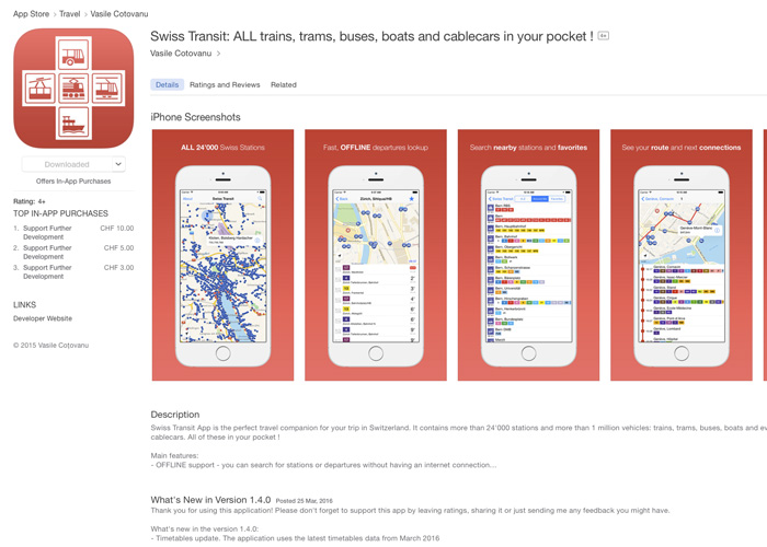
Departures iOS app for whole transit system in Switzerland (25'000 stops). Functionalities: offline support for departures, vehicle routes, nearby stations and favorites
Swiss Public Transport Stations
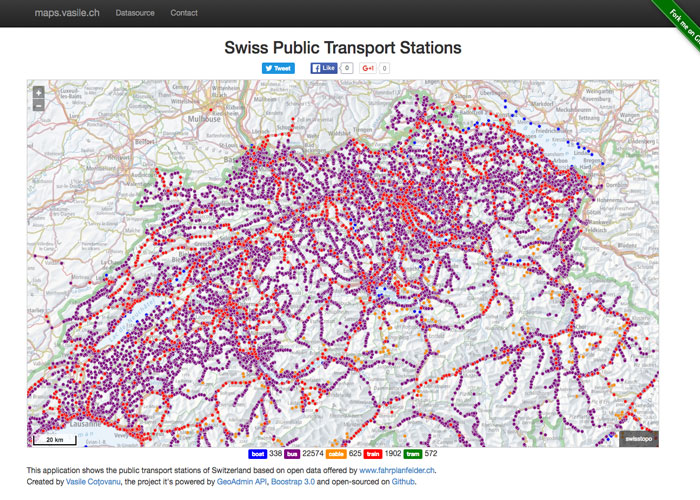
This tool and map extracts the list of the public transport stations of Switzerland from the official timetables datasets
ZVV S-Bahn Network
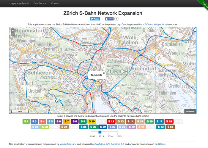
This application shows the Zürich S-Bahn Network evolution from 1990 to present day
GeoPuzzle
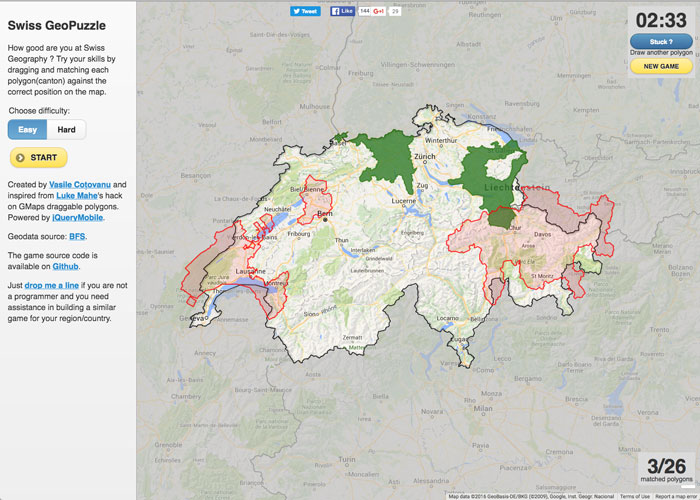
This game tests your geography skills by let you dragging and matching each polygon against the correct position on the map
Transit Map of Romania
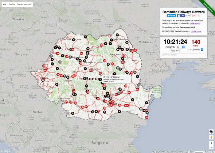
This map is based on the original #swisstrains animation and shows the romanian railways network in Romania
Swisstrains
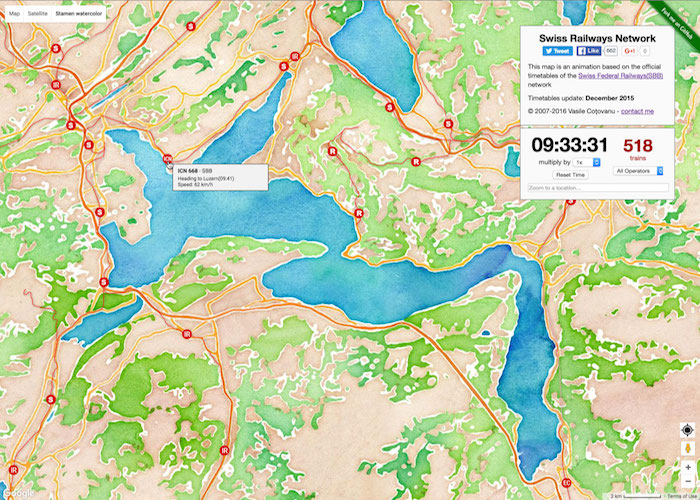
This is the original swisstrains.ch project, released in 2007 and improved several times. It's serving as a base for other public transport animations listed here